
Belfast Harbour Commissioners The UK Major Ports Group Trust Harbour Office Compulsory vessels over 75m; VTS Channel 12 24,600,000 Containers (lo/lo); River/Tidal Berths Lat: 54⁰ 36’ N; Long: 05⁰ 56’ W Manager/CEO: Joe O’Neill Harbour Master: Kevin Allen Email:[email protected] Ops Engineering Manager: Herbert Scott Open: 50,000 sq m Roads: M2 motorway to north of province; Stevedoring provided by private operators. Ship repair/graving docks;Authority/Operator:
UK Ports Association
http://www.ukmajorports.org.ukOwnership:
Contact
Corporation Square
Belfast,
Northern Ireland BT1 3AL
Tel: 028 90 554422
Fax: 028 90 554411
[email protected]
Web: www.belfast-harbour.co.ukPilotage
Approx annual tonnage
Principal traffic
Unit loads (ro/ro);
Vehicles/wheeled cargoes;
Passengers;
Dry bulks;
Grain/feedstuffs;
Refrigerated Products;
Hazardous cargoes;
Forest Products;
Oil/Petroleum;
Other liquid bulk;
General cargo;
Project cargo (heavy lift)Access/Accommodation
Max depth: 11m
Max size of vessel accepted
Beam: LOA 300m X 45m Beam X 10.4m Draft / LOA 240m X 45m Beam X 11.0m Draft
No of berths: 40
Berths total length: 8000m
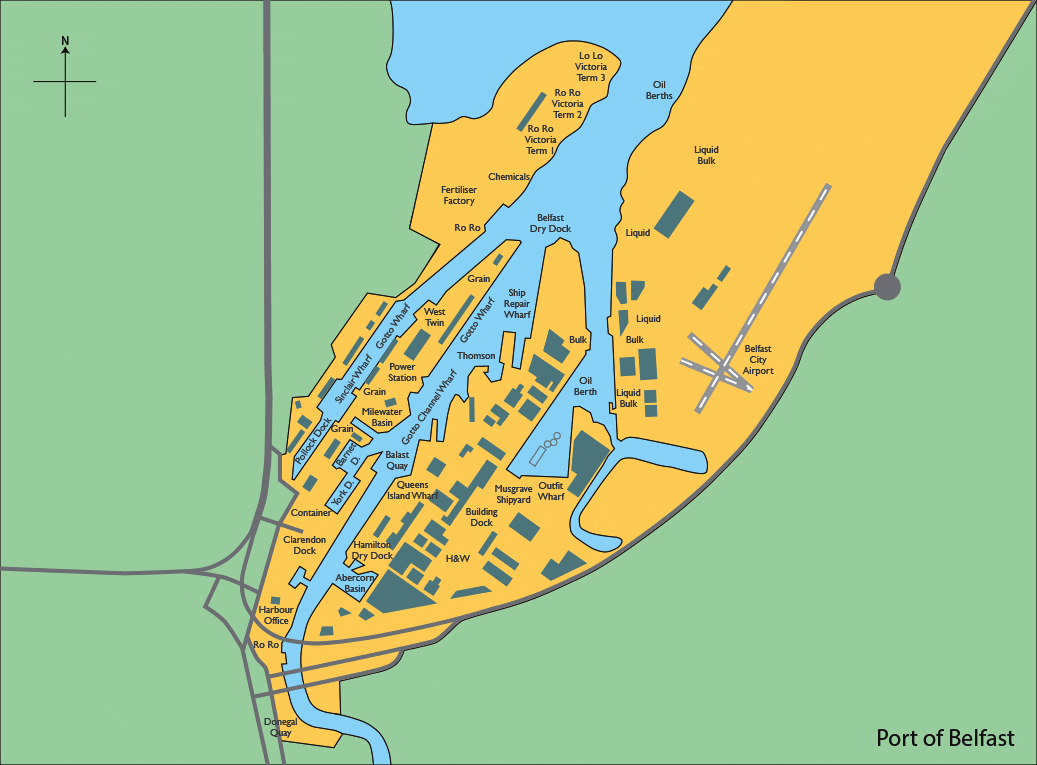
Location
A safe accessible deepwater harbour at the head of Belfast Lough, 19km west of the Irish Sea on the northeast coast of Ireland.Port contacts
Port Director: Michael Robinson
Normal hours: 0900 – 1700 24-hr Tel: 028 90 553000Storage
Covered: 80,000 sq mTransport connections
M1 motorway/westlink dual to south and west;
M3 bridge and Sydenham bypass, dual to east.
Nearest passenger rail: York Gate 2km
Nearest int’l airport: Belfast International 25kmCommercial cargo handling facilities
Cranes
Container: 1 max 30T, 6 max 40T
Rail mounted: 2 max 30T, 4 max 15T
Mobile: 3 max 100T/ 1 max 84T / 1 max 35T / 1 max 25T
Linkspans: 5 max capacity 180 tonnesFacilities & services
Lay up berths;
Chandlers;
Bunkering;
Towage;
Seamen’s Mission
Please click here if you wish to make Amendments or Additions for this Port
VESSELS IN AND AROUND THE PORT
MAP VESSEL KEY Click here to view the map vessel key

PLEASE NOTE: Vessel positions may be up to one hour old or incomplete.
Data is provided for informational reasons only and is not related by any means to the safety of navigation.